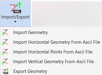
Export Geometry
 Exports the selected civil
geometry elements into LandXML.
Exports the selected civil
geometry elements into LandXML.
You can access this tool from the following:
Export Geometry Dialog
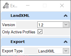
| Select in Dialog | Description |
|---|---|
|
LandXML |
Version 1.0, 1.1, 1.2, 2.0 Only Active Profiles Check on Only Active Profiles to export only the active profile associated with the selected alignment. Check off exports all the profiles active and not active associated with the selected alignment. |
|
Export |
Export Type |
Workflow
- Select export type, select LandXML Version.
- Check on Only Active Profiles or check off.
- Select Export Type. Specify the format on which you want to export the profile.
Sample Batch Files to Export Geometry to LandXML via Key-in
This enhancement allows users to run a batch file that creates a selection set of their geometry and then exports the contents of that selection set to LandXML.
- This batch file can be run in conjunction with the Batch Process tool to apply the commands across multiple DGN files.
- The Selection Set can be created via standard MicroStation commands or through the use of OpenRoads Graphical Filters (see sample below).
- An XML file will be created for each individual DGN.
- Naming convention for the XML file is <Prefix><DGN_FileName>.xml.
- If multiple alignments are found in a single DGN, all geometry in that DGN will be exported to a single XML.
Selection Set Creation
MicroStation Commands can be used (e.g. Powerselector All)- POWERSELECTOR ALL.
- REFERENCE DISPLAY OFF ALL
- ORD Graphical Filters
- Mandatory Parameters Filter=<FilterName>
- Geometry Select Byfilter Filter=SecondaryAlignments
Export to LandXML
| Mandatory Parameters BatchProcessExport | GEOMETRY LANDXML EXPORT BatchProcessExport |
|
Optional Parameters Version=<1.0, 1.1, 1.2, 2.0>/OnlyActiveProfiles=<True, False>/Prefix=<ExportedFileNamePrefix> |
Defaults Version=1.2/OnlyActiveProfiles=True/Prefix=<> |
| GEOMETRY LANDXML EXPORT BatchProcessExport | Version=1.2/OnlyActiveProfiles=True/Prefix=Geometry_ |
File Creation