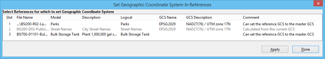
Set Geographic Coordinate System In References Dialog
Used to set the geospatial coordinate systems (GCS) of attached references based on the GCS of the active model. If the GCS is selected from the standard library, it can be used to set the GCS for coincident, unscaled, and unrotated reference attachments. If the GCS is calculated from placemark monuments, it can be used to set the GCS for unscaled references.
| Setting | Description |
|---|---|
| Select References for which to set Geographic Coordinate System | Displays the references attached to the active model. |
| Apply | Writes the GCS to the selected references using ProStructures’s reference activation feature, which has all the requirements and characteristics of reference activation. Changes cannot be undone until a writable reference is released. |