Ponds
Pond volumes are defined one of four ways:
Elevation-Area Curve
Volumes are typically defined as a series of Elevation-Area points, which are easily pulled from the contour map. The simulation then computes the volumes based on the changes in area between two elevations.
Elevation-Volume Curve
This option defines the volume directly by a series of elevation volume points. This allows for more complex storage structures that don't lend themselves to an Elevation-Area curve. If for example you have a fill, or obstructions in the pond you can enter the volume directly without having to work out adjustments to the areas.
Depth to Area Functions (ft, m)
The volume is determined based on the following function which calculates the surface area for a given depth.
Either select the function based on feet or meters
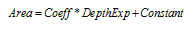
| Area | = | Surface Area at Given Depth | ft2, m2 |
|---|---|---|---|
| Coeff | = | User input value which is derived from existing volume data | ft(2-Exp), m(2-Exp) |
| Depth | = | Distance from the invert of the pond | ft, m |
| Exp | = | User input value which is derived from existing volume data | unitless |
| Constant | = | The area at the bottom of the pond and is a user input value | ft2, m2 |
Pipe Volume
The Pipe Volume option supports modeling horizontal, vertical, or sloped pipes. Typically, the upsized pipes are significantly larger than would be required to simply convey the runoff from the site. For this reason upsized pipes will be terminated by an orifice or small diameter pipe stub which will provide the necessary peak discharge control.
The Pipe option automatically generates the cumulative volume rating table needed for the simulation. It should be emphasized that in upsized pipe systems the assumption is that the water surface elevation in the upsized pipe is taken to be level. This means that inflow into the upstream end of the pipe is immediately translated to the downstream end of the pipe - the standard detention routing assumption.
Related Topics